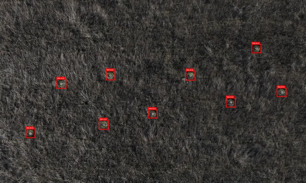
4 June 2026 - According to a new Policy Brief from Tech 4 Tracing, the use of computer vision-enabled drones to document and geolocate unexploded ordnance (UXO) in conflict zones can also contribute digital evidence for legal accountability mechanisms. That is now feasible because the photographs and orthomosaic maps that these drone-based systems generate can, if handled in compliance with legal chain of custody and data security requirements, be legally admissible in efforts to bring violators of certain weapons-related crimes to justice.
Download the Tech 4 Tracing Policy BriefThe Policy Brief describes a number of specific legal cases where such evidence may be particularly relevant, including those dealing with the use of certain prohibited weapons under treaty law, and weapons deployed in an indiscriminate manner. It provides an introduction to drone-based computer vision and object geolocation, discussing how they work and current deployment scenarios with emergency mine action actors focused on the remote UXO in conflict-affected areas. It then discusses the core principles of digital evidence and the conditions under which accountability mechanisms could admit mine-action-collected data under different bodies of law: international humanitarian law, international criminal law, and international human rights law.
This Policy Brief represents the first elaboration of the application of AI computer vision mine action technologies for weapons-related legal accountability purposes.